
Very warm Tuesday, intense heat and thick humidity expected starting Wednesday
We have a very warm day on tap for Tuesday before intense heat and thick humidity moves in starting Wednesday.
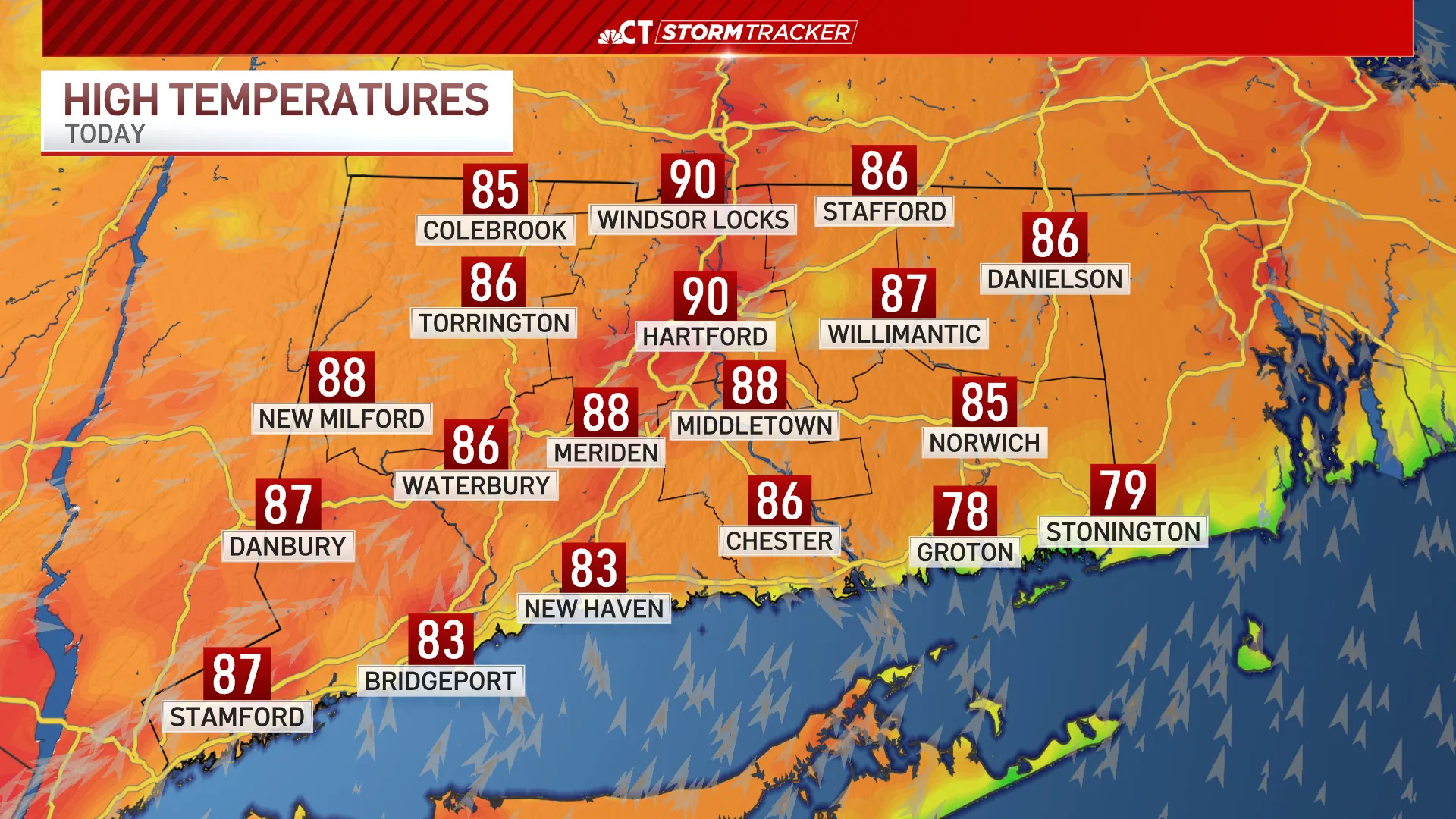
Highs on Tuesday will approach 90 and the humidity will be noticeable, but not oppressive.
A few showers and thunderstorms are possible in the evening and overnight.
Starting Wednesday, there will be intense heat and thick humidity with temperatures between 97 and 101.
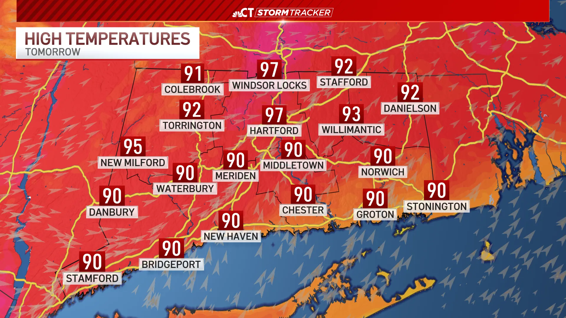
The feels-like temperatures will be between 105 and 110.
That heat is expected to peak on Thursday and Friday, but will continue into the holiday weekend.
An Extreme Heat Watch goes into effect for the entire state for Wednesday through Saturday.
Governor Ned Lamont has also activated the state’s extreme hot weather protocol starting at 12 p.m. Tuesday until at least 6 p.m. Sunday. As part of the state’s hot weather protocol, cooling centers will open across Connecticut for anyone who needs relief from the heat. Residents can find the nearest cooling center by visiting 211ct.org or by calling 2-1-1.


From breaking news and local politics to art exhibitions, live music, high school sports, small businesses, and cultural events, we celebrate the people and places that make Connecticut unique.