Blizzard impacts to be felt across Connecticut Sunday evening to Monday evening
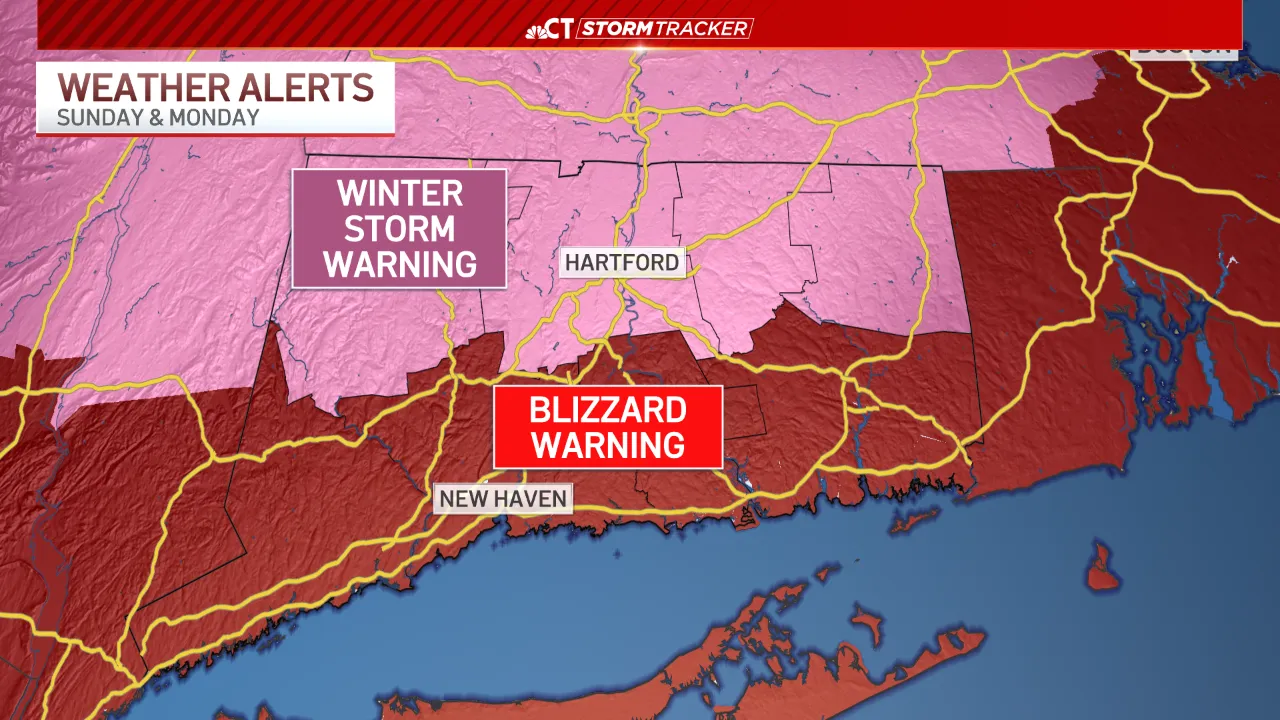
Blizzard and winter storm warnings are in effect across Connecticut ahead of a nor’easter.
While you may see a few light snow showers through Sunday, the widespread snow will begin after 4 p.m. It will quickly become heavy through the evening hours. Heavy snow is expected through Monday morning before gradually tapering through the afternoon.
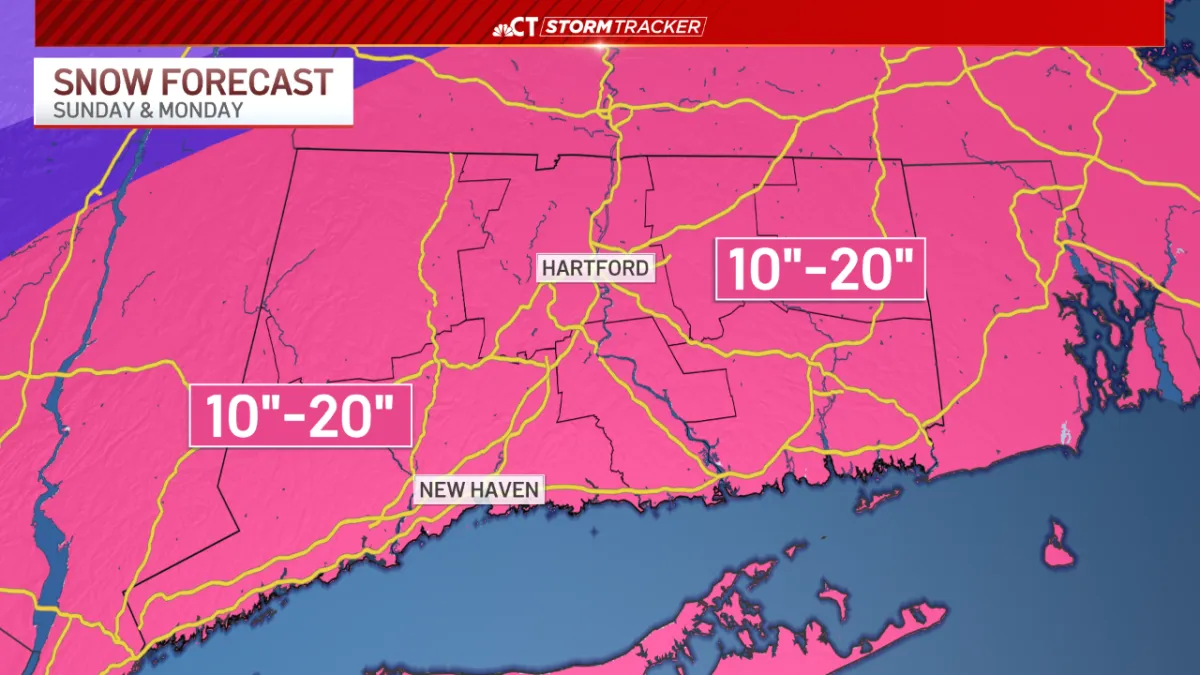
Once all is said and done, 10-20 inches of snow will have accumulated across the state. A few areas may see totals closer to 2 feet.

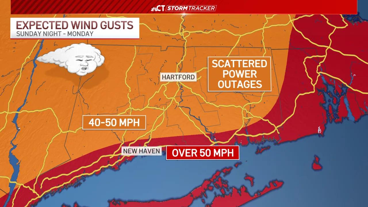
Winds will gust between 40-50 miles per hour through the majority of Sunday night and Monday. A few isolated gusts could be upwards of 60 miles per hour, especially at the shoreline.
This wind could lead to scattered power outages and very low visibility through the storm. Whiteout conditions are likely at times across the state tonight and tomorrow.
Winds will die down through Monday night and into Tuesday.
Stay with NBC Connecticut as we track this storm.


From breaking news and local politics to art exhibitions, live music, high school sports, small businesses, and cultural events, we celebrate the people and places that make Connecticut unique.