
Nor'easter could bring heavy snow and strong winds by Monday
Parts of Connecticut have the chance to see high snow totals, strong winds, and low visibility through late Sunday and Monday.
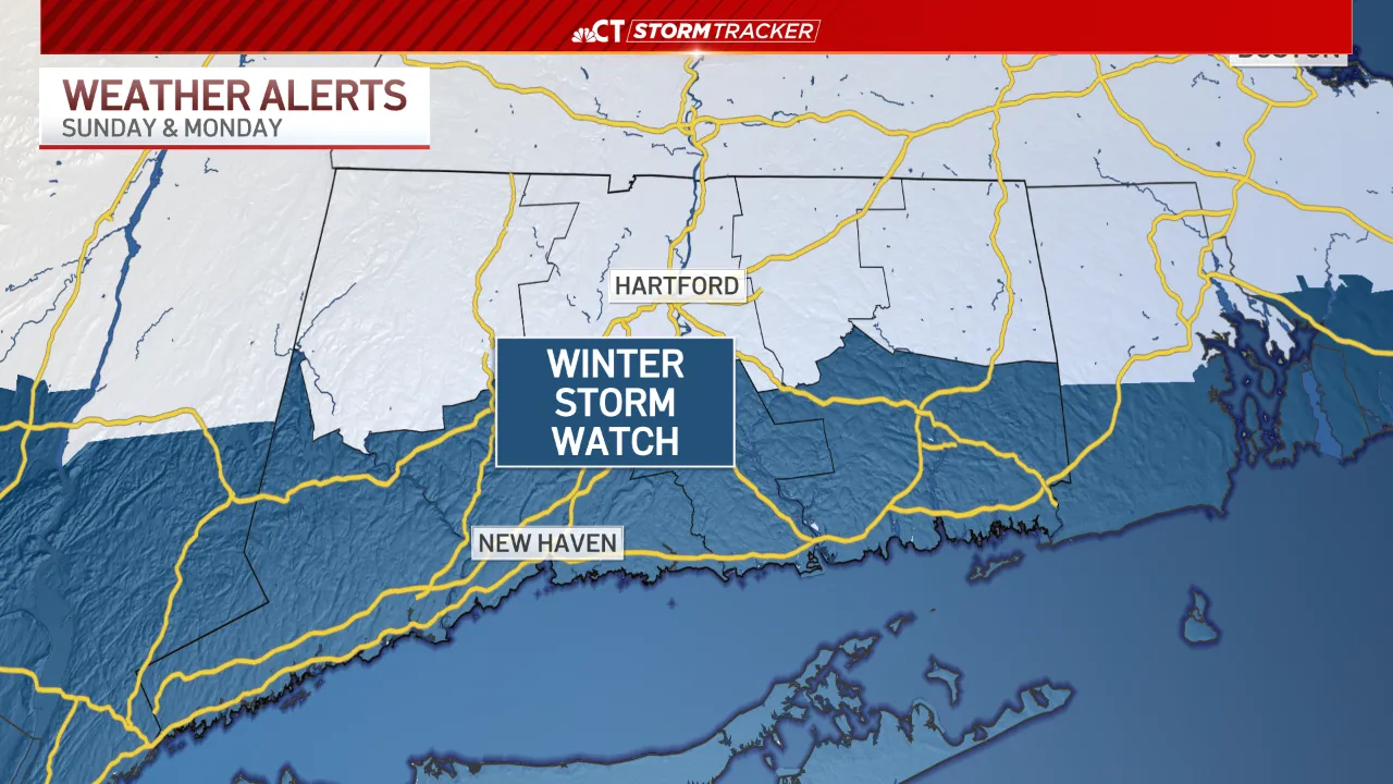
A winter storm watch has been issued for southern Connecticut, as that area has the highest potential to see the largest amounts and strongest winds.
A few snow showers are possible at times on Sunday, but the core of this system will approach us on Sunday night.
The highest travel impacts are expected to come Monday morning with slippery roads and low visibility expected.
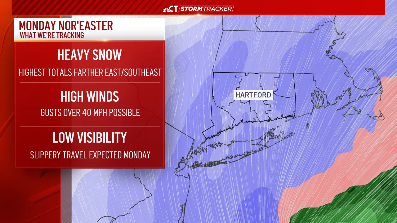
Heavy snow and strong winds are expected through late Sunday night and Monday. Snow will gradually taper through Monday afternoon and evening.
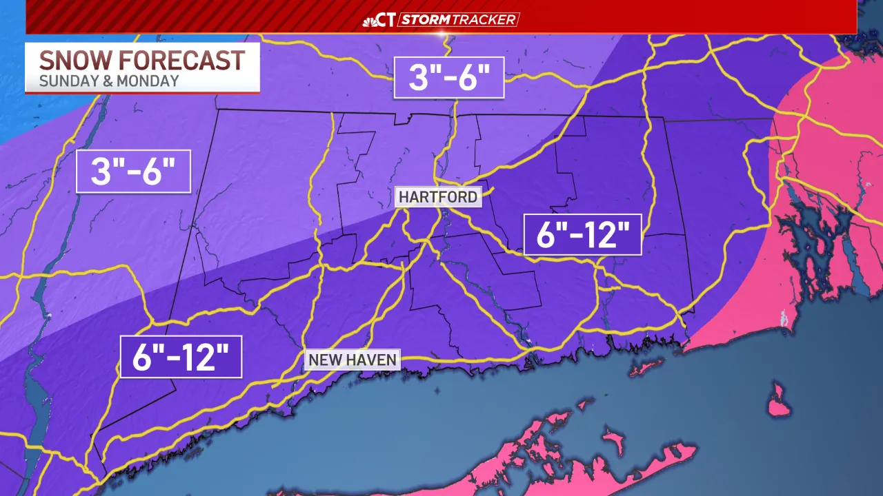
Once all is said and done, 6 to 12 inches of snow will accumulate across parts of the state, especially along and southeast of I-84.
This forecast is subject to change, so stay updated with the latest conditions through the weekend.


From breaking news and local politics to art exhibitions, live music, high school sports, small businesses, and cultural events, we celebrate the people and places that make Connecticut unique.